Just the Flight's Travel Blog
Which Country Is Best to Work In?

Travelling around the world on a holiday can be a great opportunity to relax and get away from the stress that work seems to inevitably bring. But have you ever stopped to wonder if you could be getting more money for your time spent working in another country? Is your time worth more across the Atlantic, or at a location in Europe? We have analysed the average working hours, wage, money earned per hour, and number of years to enjoy retirement around the world, so you might consider turning your week away into a permanent stay!
Read more: Which Country Is Best to Work In?
In Flight Menu Excess
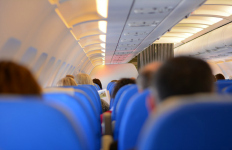
When you’re sat on your plane jetting off on holiday, it’s nice to be able to reward yourself with a few refreshments from the in-flight menu. Whether it’s a nice soft drink to cool down, a tasty sandwich, or maybe even a beer to unwind until you touch down at your destination. But how much would you be willing to spend on sustenance from the in-flight menu? And at what point would it be more efficient to simply buy a business class ticket to benefit from the complimentary food?
Read more: In Flight Menu Excess
People We Hate at the Beach
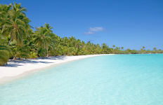
When we think of the beach we think of white sand, the glowing sun and crystal blue waters. What we don’t think of are people hollering and getting drunk, flocks of angry seagulls trying to steal food, and people flashing ungodly parts of their body. Urgh! No matter how great of a place the beach is, you’ll always find someone who’s set on ruining your day. Make sure you check out our fantastic new infographic where we rank some of the absolute worst beach behaviours, based on another famed Just The Flight survey!
Read more: People We Hate at the Beach
11 Graphs That Perfectly Sum Up Travel

Travelling has become so normal to most of us that we have become unaware of the curious eccentricities that accompany the process. These peculiarities infuse themselves through every stage of travelling, from the act of preparing for the trip, through the airport, flight and holidaying – they even are present during the aftermath of time spent away! Here at Just The Flight we have decided to celebrate the strange quirks of travel through the medium of graphs, summing up exactly what it means to travel – check them out now!
Read more: 11 Graphs That Perfectly Sum Up Travel
Tourism Campaigns - The High Flyers and Backfires
What do you look for when booking a holiday? Tourism campaigns to advertise a destination can help to persuade and inspire future trips and convince the choice of one country over another. However, they are not always a success! We have explored some of the campaigns that failed to get off the ground, as well as examining those that got it spot on and made waves! Banners, barbeques, babies and Breaking Bad (we’re not joking!) – check out some of the best and worst tourism campaigns ever released!
Read more: Tourism Campaigns - The High Flyers and Backfires
Across The Pond - Evolution of Transatlantic Crossings
Nowadays if you wanted to take a trip across the pond, you would probably book a flight and hop on a plane to enjoy a quick and comfortable flight to your destination. But this hasn’t always been the case, nor have planes always been the chosen method of travel! From the first trips across the Atlantic to the fastest journeys – we have explored the most daring transatlantic travel throughout history! Some may just make you a lot more grateful for the convenience of inflight entertainment!
Read more: Across The Pond - Evolution of Transatlantic Crossings
Borderline Crazy International Borders
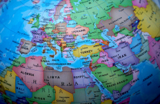
Looking at a world map or globe and you’d be forgiven for thinking that the countries of the world are neatly divided into individual territories. However, the truth of the matter is that country borders are not always as simple, nor as logical as they can appear at first glance! From countries surrounded entirely by a single other country, to the border so dangerous for humans that it has become an accidental and unofficial nature reserve, we have explored the most mind-blowing borders on the planet!
Read more: Borderline Crazy International Borders
Airports Furthest From Their Cities
Flying is a fantastic way of getting from A to B quickly and in style, however, once the flight touches down, making your way into the city can be a slightly trickier task. It turns out, not all airports are named with the onward journey in mind, with some being quite a distance away from the city they purport to serve. But there is no need to get caught out (and stuck with additional hours on to your journey!) – here at Just The Flight we have found the worst offending airports to look out for and calculated how long it could add to your journey!
Read more: Airports Furthest From Their Cities
Fictional Airlines

Just as when you or I decide to jet off on holiday or need a long-distance business trip, people in fictional worlds also must find a way to fly when required. And how else would they book their tickets and check-in their bags without the many fictional airlines out there? But unlike the routine flights that take to the skies thousands of times a day, these fictional airlines have a tendency to encounter some issues in-flight! So have a look at our infographic to see how many of these airlines you recognise from television, film and video game!
Read more: Fictional Airlines
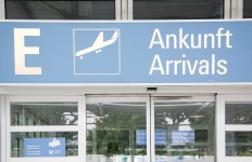
Just The Flight launches the Jetter Sweater
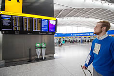
Here at Just The Flight we want your flight to run as smoothly as possible, with as little stress and annoyance as possible so when 48% of people stated that people who misplace their passport are the most annoying people to encounter in an airport, that got us thinking. How can we stop people from losing their vital documents and streamline the airport experience? What emerged is something glorious; a combination of style and ingenuity with flawless practicality. We would like to introduce the Just The Flight Jetter Sweater…
Read more: Just The Flight launches the Jetter Sweater
Copyright Mann Link Travel Ltd. 44 Strand Street, Douglas, Isle of Man, IM1 2EL